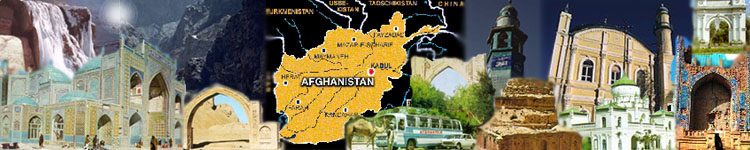
AFGHANISTAN, a mountainous, landlocked
country of Asia. Wedged between Turkmenistan, Uzbekistan, Tajikistan, China, Pakistan, and
Iran, it lies-literally and figuratively-at the crossroads between East and West.
Afghanistan, with a population of diverse ethnic origins
and customs, is a nation in transition, attempting to achieve national unity and to bridge
the gap between a tradition-bound feudal society and a modern industrialized state.
An ancient, much plundered land, Afghanistan achieved at
least a superficial measure of national unity in 1747 and became nominally a
constitutional monarchy in 1931. In 1973 the monarchy was overthrown in a bloodless coup,
and a republic was established.
The new republic and its constitution of 1977 failed to
survive the “Great Saur Revolution” of 1978, which brought into being a Marxist
state under the patronage of the Soviet Union.
Even with Soviet support the new Afghanistan was unable
to win the allegiance of its Muslim population, whose disaffection ripened into
insurgency. Impatient with the failures of the Afghan regime to suppress rebellion, the
Soviet Union airlifted thousands of troops into the country in late December 1979 and
installed a puppet regime.
A shared hatred of the Soviet invader came as close as
anything had in the past to unify, at least temporarily, the generally discordant tribes
of Afghanistan, whose primary allegiance was traditionally to the family, the village, and
the lineage group rather than to the nation.
In 1988, after more than eight years of inconclusive
warfare against rebel forces, the Soviet Union began to pull its troops out. With the
completion of the Soviet withdrawal in 1989, the Communist government and army of
Afghanistan did not collapse as expected but retained control of the principal cities.
Much of the countryside, however, was in the hands of
various rebel regional commanders.
Geography:
Location: Southern Asia, north and west of Pakistan, east of Iran
Geographic coordinates: 33 00 N, 65 00 E
Map references: Asia
Area:
total: 647,500 sq km
land: 647,500 sq km
water: 0 sq km
Area - comparative: slightly smaller than Texas
Land boundaries:
total: 5,529 km
border countries: China 76 km, Iran 936 km, Pakistan 2,430 km, Tajikistan
1,206 km, Turkmenistan 744 km, Uzbekistan 137 km
Coastline: 0 km (landlocked)
Maritime claims: none (landlocked)
Climate: arid to semiarid; cold winters and hot summers
Terrain: mostly rugged mountains; plains in north and southwest
Elevation extremes:
lowest point: Amu Darya 258 m
highest point: Nowshak 7,485 m
Natural resources: natural gas, petroleum, coal, copper, talc, barites, sulfur,
lead, zinc, iron ore, salt, precious and semiprecious stones
Land use:
arable land: 12%
permanent crops : 0%
permanent pastures: 46%
forests and woodland: 3%
other: 39% (1993 est.)
Irrigated land: 30,000 sq km (1993 est.)
Natural hazards: damaging earthquakes occur in Hindu Kush mountains;
flooding
Environment - current issues: soil degradation; overgrazing; deforestation
(much of the remaining forests are being cut down for fuel and building
materials); desertification
Environment - international agreements:
party to : Desertification, Endangered Species, Environmental Modification,
Marine Dumping, Nuclear Test Ban signed, but not ratified: Biodiversity, Climate Change,
Hazardous Wastes, Law of the Sea, Marine Life Conservation
Geography - note: landlocked
People:
Population: 23,738,085 (July 1997 est.)
Age structure:
0-14 years: 43% (male 5,201,585; female 5,003,503)
15-64 years: 54% (male 6,680,687; female 6,208,463)
65 years and over: 3% (male 341,301; female 302,546) (July 1997 est.)
Population growth rate: 4.48% (1997 est.)
note: this rate reflects the continued return of refugees
Birth rate: 42.72 births/1,000 population (1997 est.)
Death rate: 17.78 deaths/1,000 population (1997 est.)
Net migration rate: 19.9 migrant(s)/1,000 population (1997 est.)
Sex ratio:
at birth: 1.05 male(s)/female
under 15 years : 1.04 male(s)/female
15-64 years: 1.08 male(s)/female
65 years and over: 1.13 male(s)/female
total population: 1.06 male(s)/female (1997 est.)
Infant mortality rate: 146.7 deaths/1,000 live births (1997 est.)
Life expectancy at birth:
total population : 46.34 years
male: 46.89 years
female: 45.76 years (1997 est.)
Total fertility rate: 6.07 children born/woman (1997 est.)
Nationality:
noun: Afghan(s)
adjective: Afghan
Ethnic groups: Pashtun, Tajik, Uzbek, Hazara,
minor ethnic groups: (Aimaks, Turkmen, Baloch, and others)
Religions: Sunni Muslim 84%, Shi'a Muslim 15%, other 1%
Languages: Pashtu, Afghan Persian (Dari), Turkic languages
(primarily Uzbek and Turkmen), 30 minor languages (primarily Balochi
and Pashai), much bilingualism
Literacy:
definition: age 15 and over can read and write
total population: 31.5%
male : 47.2%
female: 15% (1995 est.)
Government:
Country name:
conventional long form: Islamic State of Afghanistan
conventional short form: Afghanistan
local long form : Dowlat-e Eslami-ye Afghanestan
local short form: Afghanestan
former: Republic of Afghanistan
Data code: AF
Government type: transitional government
National capital: Kabul
Administrative divisions: 30 provinces (velayat, singular - velayat);
Badakhshan, Badghis, Baghlan, Balkh, Bamian, Farah, Faryab, Ghazni, Ghowr,
Helmand, Herat, Jowzjan, Kabol, Kandahar, Kapisa, Konar, Kondoz, Laghman,
Lowgar, Nangarhar, Nimruz, Oruzgan, Paktia, Paktika, Parvan, Samangan,
Sar-e Pol, Takhar, Vardak, Zabol
note : there may be two new provinces of Nurestan (Nuristan) and Khowst
Independence: 19 August 1919 (from UK control over Afghan foreign
affairs)
National holiday: Victory of the Muslim Nation, 28 April; Remembrance Day
for Martyrs and Disabled, 4 May; Independence Day, 19 August
Constitution: none
Legal system: a new legal system has not been adopted but all factions tacitly
agree they will follow Islamic law (Shari'a)
Suffrage: undetermined; previously males 15-50 years of age
Executive branch:
Riaset Jamhoury Dawlat-e-Islami Afghanistan.
Political parties and leaders:
Jamiat-i-Islami (Islamic Society), Burhanuddin RABBANI and Ahmad Shah
MASOOD;Jumbesh-i-Melli Islami (National Islamic Movement), Abdul Rashid DOSTAM;
and Hizbi Wahdat-Khalili faction (Islamic Unity Party), Abdul
Karim KHALILI]; other smaller parties are Hizbi Islami-Gulbuddin (Islamic
Party), Gulbuddin HIKMATYAR faction; Hizbi Islami-Khalis (Islamic Party),
Yunis KHALIS faction; Ittihad-i-Islami Barai Azadi Afghanistan (Islamic
Union for the Liberation of Afghanistan), Abdul Rasul SAYYAF;
Harakat-Inqilab-i-Islami (Islamic Revolutionary Movement), Mohammad Nabi
MOHAMMADI; Jabha-i-Najat-i-Milli Afghanistan (Afghanistan National
Liberation Front), Sibghatullah MOJADDEDI; Mahaz-i-Milli-Islami (National
Islamic Front), Sayed Ahamad GAILANI; Hizbi Wahdat-Akbari faction
(Islamic Unity Party), Mohammad Akbar AKBARI; Harakat-i-Islami (Islamic
Movement), Mohammed Asif MOHSENI
Political pressure groups and leaders: tribal elders represent traditional
Pashtun leadership; Afghan refugees in Pakistan, Australia, US, and elsewhere
have organized politically; Peshawar, Pakistan-based groups such as the
Coordination Council for National Unity and Understanding in Afghanistan
(CUNUA), Ishaq GAILANI; Writers Union of Free Afghanistan (WUFA), A.
Rasul AMIN; Mellat (Social Democratic Party), leader NA
International organization participation: AsDB, CP, ECO, ESCAP, FAO,
G-77, IAEA, IBRD, ICAO, ICRM, IDA, IDB, IFAD, IFC, IFRCS, ILO, IMF,
Intelsat, IOC, IOM (observer), ITU, NAM, OIC, UN, UNCTAD, UNESCO,
UNIDO, UPU, WFTU, WHO, WMO, WToO
Flag description: three equal horizontal bands of green (top), white, and black
with a gold emblem centered on the three bands; the emblem features a
temple-like structure with Islamic inscriptions above and below, encircled by a
wreath on the left and right and by a bolder Islamic inscription above, all of
which are encircled by two crossed scimitars
Economy:
Economy - overview: Afghanistan is an extremely poor, landlocked country,
highly dependent on farming and livestock raising (sheep and goats). Economic
considerations have played second fiddle to political and military upheavals
during more than 17 years of war, including the nearly 10-year Soviet military
occupation (which ended 15 February 1989). During the war one-third of the
population fled the country, with Pakistan and Iran sheltering a combined peak
of more than 6 million refugees. Now, only 750,000 registered Afghan refugees
remain in Pakistan and about 1.2 million in Iran. Another 1 million have probably
moved into and around urban areas within Afghanistan. Gross domestic product
has fallen substantially over the past 17 years because of the loss of labor and
capital and the disruption of trade and transport. Millions of people continue to
suffer from insufficient food, clothing, housing, and medical care. Inflation
remains a serious problem throughout the country, with one estimate putting the
rate at 240% in Kabul in 1996. Numerical data are likely to be either
unavailable or unreliable.
GDP: purchasing power parity - \\$18.1 billion (1996 est.)
GDP - real growth rate: NA%
GDP - per capita: purchasing power parity - \\$800 (1996 est.)
GDP - composition by sector:
agriculture: 56%
industry: 15%
services: 29%
Inflation rate - consumer price index: 240% (1996 est.)
Labor force:
total: 7.1 million
by occupation: agriculture and animal husbandry 67.8%, industry 10.2%,
construction 6.3%, commerce 5.0%, services and other 10.7% (1980 est.)
Unemployment rate: 8% (1995 est.)
Budget:
revenues: \\$NA
expenditures: \\$NA, including capital expenditures of $NA
Industries: small-scale production of textiles, soap, furniture, shoes,
fertilizer,
and cement; handwoven carpets; natural gas, oil, coal, copper
Electricity - capacity: 371,000 kW (1993)
Electricity - production: 670 million kWh (1994)
Electricity - consumption per capita: 35 kWh (1995 est.)
Agriculture - products: wheat, fruits, nuts, karakul pelts; wool, mutton
Exports:
total value: \\$80 million (1996 est.)
commodities: fruits and nuts, handwoven carpets, wool, cotton, hides and pelts,
precious and semi-precious gems
partners : FSU, Pakistan, Iran, Germany, India, UK, Belgium, Luxembourg,
Czechoslovakia
Imports:
total value : \\$150 million (1996 est.)
commodities: food and petroleum products; most consumer goods
partners: FSU, Pakistan, Iran, Japan, Singapore, India, South Korea, Germany
Debt - external: \\$2.3 billion (March 1991 est.)
Economic aid:
recipient: ODA; about \\$56 million in UN aid plus additional bilateral aid and aid
in kind (1996)
note: US provided \\$450 million in bilateral assistance (1985-93); US continues
to contribute to multilateral assistance through the UN programs of food aid,
immunization, land mine removal, and a wide range of aid to refugees and
displaced persons
Currency: 1 afghani (AF) = 100 puls
Exchange rates: afghanis (Af) per US\\$1 - 17,000 (December 1996), 7,000
(January 1995), 1,900 (January 1994), 1,019 (March 1993), 850 (1991); note -
these rates reflect the free market exchange rates rather than the official
exchange rate, which is a fixed rate of 50.600 afghanis to the dollar
Fiscal year: 21 March - 20 March
Communications
Telephones: 31,200 (1983 est.)
Telephone system:
domestic: very limited telephone and telegraph service
international: satellite earth stations - 1 Intelsat (Indian Ocean) linked only to
Iran and 1 Intersputnik (Atlantic Ocean Region)
Radio broadcast stations: AM 6, FM 0, shortwave 2
Radios: 1.8 million (1996 est.); note - about 60% of families own a radio
Television broadcast stations: NA
note: one television station run by Jumbesh faction provides intermittent service
Televisions: 100,000 (1993 est.)
Transportation:
Railways:
total: 24.6 km
broad gauge: 9.6 km 1.524-m gauge from Gushgy (Turkmenistan) to
Towraghondi; 15 km 1,524-m gauge from Termiz (Uzbekistan) to Kheyrabad
transshipment point on south bank of Amu Darya
Highways:
total: 21,000 km
paved: 2,793 km
unpaved: 18,207 km (1995 est.)
Waterways: 1,200 km; chiefly Amu Darya, which handles vessels up to about
500 DWT
Pipelines: petroleum products - Uzbekistan to Bagram and Turkmenistan to
Shindand; natural gas 180 km
Ports and harbors: Kheyrabad, Shir Khan
Airports: 33 (1996 est.)
Airports - with paved runways:
total: 16
over 3,047 m: 3
2,438 to 3,047 m: 4
1,524 to 2,437 m : 2
under 914 m: 7 (1996 est.)
Airports - with unpaved runways:
total: 17
2,438 to 3,047 m: 3
1,524 to 2,437 m: 12
914 to 1,523 m: 2 (1996 est.)
Heliports: 3 (1996 est.)
Military
Military branches: NA; note - the military does not exist on a national
basis;
some elements of the former Army, Air and Air Defense Forces, National
Guard, Border Guard Forces, National Police Force (Sarandoi), and tribal
militias still exist but are factionalized among the various groups .
[ Home ] [ Afghan Culture Invading City ] [ Cities ] [ History ] [ Last 60 Years ] [ Flags ] [ Ethnic Groups & Languages ] [ Education ] [ Architaktur ]